ADDISON GREEN
  • Illustration
  • 100 Heads
  • Landscapes
  • Sketchbooks
  • Wandering Addison
  • Contact

You Are Here: Part 1

4/7/2023

0 Comments

 
Picture
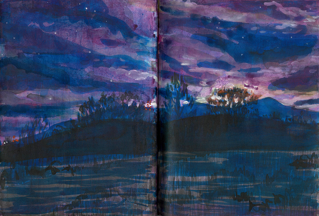
Before sunrise on the prairie at Fountain Valley

After I graduated high school, I took a month-long 27 State road trip with four friends. I wrote this series about it when I was in college, and only a few years after this trip took place. That was almost exactly half a lifetime ago for me. I'm retracing many of these steps, so I thought I'd share it again while I do the boring stuff like work on a commission at the local public library in Ft. Myers.
​
From the passenger’s seat, the dotted yellow line that divides the highway disappears into the center of the dashboard. When you pass each one, it flicks out of view and seemingly out of existence. As a child, I would imagine there was a large red marker attached to the bottom of our car, drawing a line from one dash to another. Each mile marker we passed was like a number in a connect-the-dots coloring book, and if we drove long enough, we would connect all of the numbers to reveal the previously hidden image. I liked to guess what that image would be, especially after a drive through the mountains where the roads are windy and narrow, but I could never be sure what the picture actually looked like. I could not rise high enough above the road without losing my frame of reference.

In 2005, Google launched Google Maps. By May of 2007, Google unveiled Google Street View in five different cities, including Denver, Colorado, where I was born. Street view allows the user to type in an address and then to zoom in to view the location from 360 degrees. By that time, I was a freshman in college and hadn’t lived in Denver for more than eight years but the subsequent stints in Kansas City, Colorado Springs, and most recently, Washington DC, had left me confused as to where I was from, so I fantasized that Denver was still my home. When Street View was launched, I typed in the address of my first home on York Street and double clicked on the appropriate thumbnail. The picture was taken on a sunny day, and I found the house tucked between an old two-story apartment building and a red brick house that used to belong to a man named Daryl. After we left it, the new owners tore off the English Ivy and painted the house a shade of white that Eddie Bauer would refer to as “taupe.” My mother’s garden was gone. The old door with the oval glass window was still there, but the navy blue paint had been stripped and the wood stained a golden yellow, which would have looked nice peeking through the ivy had it been there. Seeing the house made me feel old and disconnected so I spun the compass in the upper left corner of the application to face east up the street. A yellow line appeared on the road overlaid with a white arrow. I clicked on the arrow and the image dissolved while a new one appeared. I was now twenty feet farther down the road and another arrow lay before me, waiting for me to click it so it could draw me even farther away. I clicked it. I clicked the next. I clicked a few more. I spun the compass around, to look behind me and my old home had vanished. My previous homeless ache had dulled and I turned around and moved on through my virtual world of fish-eyed photographs.

I typed in my next address, this one for the house we had lived in after my brother was born. It was in suburban Denver and hadn’t changed much since I had seen it last, but a few plants betrayed the passage of time. The trees in the neighbor’s yard no longer looked like Charlie Brown’s Christmas tree and now resembled the mighty spruce after which the street had been named, and again, my mother’s garden was gone. I didn’t stay long. Without kids riding their bikes down the street, or the neighbor’s escaped puppy, Jake, running through our front yard, the scene didn’t have anything interesting to show and I grew bored. So I moved on.

Google would expand Street View to include most of the United States and several countries around the world. Eventually, the company would introduce the application to Google Earth, a virtual globe which allows users move about a world which has been pieced together from satellite images. Users can zoom in on any point, falling from space towards the earth, like a meteor. With the loss of elevation, labels appear and disappear. Borders melt and the image pixilates and then sharpens until you stop and hover 200 feet above the ground. You can then decide to click on Street View or continue to fly above the city, watching as reviews for nearby businesses or for areas of local interest pop up. On the ground, the yellow line with the white arrows will appear and you can click them, connecting each dot without ever leaving the office. Most of the images I have chosen are of places I have already been—My grandmother’s house, my elementary school, or the gym, and I am amused by what home looks like from the sky. Sometimes, I choose places I will never go, as I test my own freedom to swoop over to Morocco or Paris, clicking indiscriminately on street scenes that I will never bother to compare with the real thing. In all of these places, the yellow line is there, beckoning me to imagine myself in a car, watching as each point vanishes behind the dashboard.

0 Comments


Leave a Reply.

    Addison Green

    The day-to-days of an Itinerant Illustrator

    Archives

    July 2023
    May 2023
    April 2023
    March 2023
    March 2022
    December 2021
    January 2020
    December 2019
    July 2017
    January 2016
    July 2015
    June 2015
    May 2015
    January 2015
    December 2014
    November 2014

    Categories

    All

    RSS Feed

Proudly powered by Weebly
  • Illustration
  • 100 Heads
  • Landscapes
  • Sketchbooks
  • Wandering Addison
  • Contact